
Find Selma Street Records Step by Step
A Selma street directory search should move from a stable land key to a dated person clue. The county Assessor, GIS portal, Recorder, city departments, voter rules, and library shelves each see a different part of the address. Use the sequence below when the goal is to understand who owned, applied, voted, or was listed at a place.
- Normalize the number, direction, street name, city, ZIP, and any older alias. Keep Nebraska Avenue and 2nd Avenue in the same research note when the address is near that corridor.
- Find a known APN or legal description through a permitted assessor, parcel-map, or counter channel. Do not assume an open reverse-address result exists.
- Use Fresno GIS to identify the parcel shape and adjacent APNs, then record map layers and the reference date.
- Search the Fresno Recorder by owner or other indexed party, using the APN, document number, date, type, or legal description when available.
- Ask Selma Building or Planning for a precise permit or project record, and compare Haines or telephone books for listed past occupants.
The result is a parcel-by-parcel evidence trail. It is more careful than treating every name connected to a street as a current resident.
Selma Records You Can Read by Street
Address-keyed material in Selma is spread across several custodians. The Assessor links assessment facts to a parcel when the lawful access route supplies the key. GIS shows geometry and planning geography. The Recorder is indexed by party and instrument, not by a simple street-wide resident query. City permit files can name applicants, owners, contractors, or representatives. A voter file is restricted and is not an open browse by street. Haines criss-cross volumes offer a historical address-to-listing path.
| Address record | Keeper | Useful clue | Access channel |
|---|---|---|---|
| Assessment and roll products | Fresno County Assessor | APN, assessee, value, mailing lead | Value page, counter, purchased roll |
| Parcel and planning map | Fresno County GIS | Shape, APN, city line, zoning, flood layer | Free map and catalog |
| Deeds, liens, and maps | Fresno County Recorder | Parties, transfers, dates, legal description | Online, mail, counter, paid copies |
| Permits and code matters | Selma Building and Planning | Project address, applicant, contractor, work date | OpenGov start point or CPRA request |
| Criss-cross and phone books | Fresno library collections | Dated listed occupant or subscriber | On-site, microform, staff help |
These sources can join through an APN or legal description, but the person role remains distinct. An owner can receive mail elsewhere. A contractor can work at a property without living there. A directory entry can name one household member while omitting others.
Selma Street Records After the 2025 Change
The largest current obstacle in a Selma street directory search is the Fresno Assessor’s privacy change. On January 1, 2025, the county removed online address-to-APN and APN-to-address matching. The public value lookup remains useful for assessment information, but it should not be described as an unrestricted owner-name and street-address search. A known APN, book and page, legal description, map, purchased data file, or counter question becomes the bridge.
The former embedded parcel lookup form documents APN Book, APN Page, APN Block or Parcel, Street Number, Direction, Street Name, and City fields. Those fields explain how an older street workflow was designed. They do not guarantee that a current public result will return. Assessor counter staff can be reached at Hall of Records, 2281 Tulare Street, Room 201, Fresno, 559-600-3534; the Assessor contact page separates the division phone and email paths.
The county also sells whole-county products through its assessment-roll program: an annual secured roll, current owner and mailing text or CSV, an annual situs index, quarterly sales, tax-area material, and parcel characteristics. The published prices are $25.10 for quarterly sales, $48.70 for the annual secured roll, $30.94 for the monthly owner and mailing text or CSV, $29.21 for the annual situs index, and $15,425.25 for the full property-characteristics file. Free annual roll PDFs omit assessee names. Delivery is by CD, requester FTP, or Dropbox after payment.
| Visible key | Format and current caution |
|---|---|
| APN book, page, block or parcel | Short parcel components shown in the legacy interface; a known APN is the strongest modern starting key. |
| Street number and direction | Former address inputs; do not promise open address-to-APN matching after January 1, 2025. |
| Street name and city | Legacy text and city choice, including Selma; city limits and postal labels are separate questions. |
| Owner, mailing, value, and tax year | Roll evidence obtained through permitted channels; mailing is not proof of occupancy. |
Note: The Assessor is not a surveyor, so parcel lines should be checked against deeds, plats, and recorded maps.
Fresno GIS for Selma Street Parcels
The Fresno County GIS Portal is the free map step in a Selma street directory. Browse the catalog, zoom to a known parcel, turn on the available parcel or planning layers, and identify adjacent polygons. The research confirms parcel numbers, addresses, city limits, streets, zoning, and flood information as the public map’s useful geography. Ownership questions are directed back to the Assessor.
GIS is not a survey and it does not provide a verified one-click “show all neighbors and owners” export. The adjacent-parcel method is deliberate: capture the APN or parcel number first, then resolve owner or mailing evidence through the lawful assessor or Recorder path. Government parcels and no-situs parcels may disappear from an assessment product even though their geometry is visible.
The map is especially useful when a street record looks wrong. Compare a parcel’s shape, subdivision, lot or block, city line, and neighboring APNs. If the map and address do not align, test a recorded tract or parcel map, an older legal description, and a street alias before rejecting the match.
The Assessor mapping guidance shows why the parcel key matters in a county where APNs can change after a split, merge, survey, or map-book renumbering:
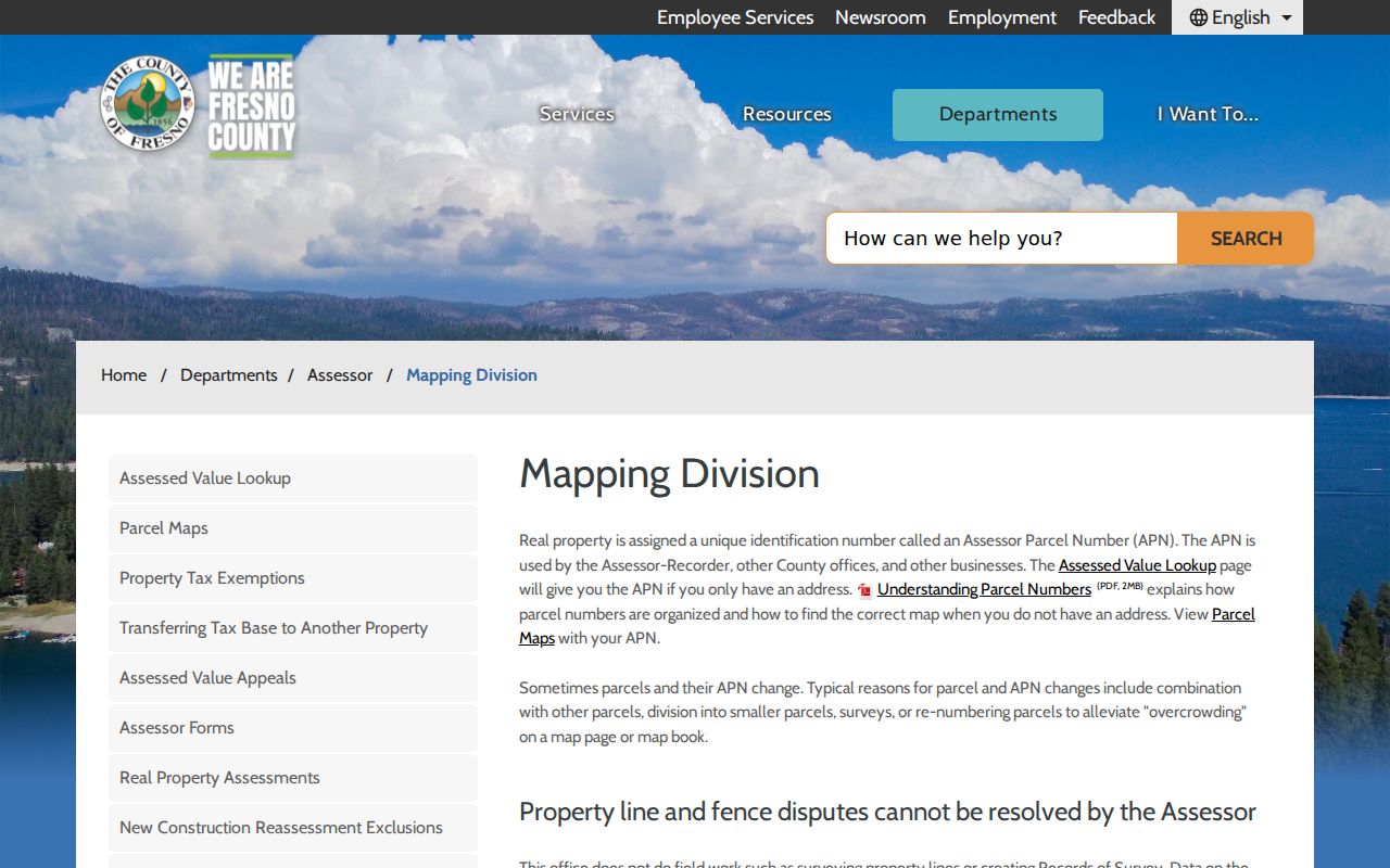
The mapping view helps turn an address into a stable research question, even when the public reverse-address service is no longer available.
The Railroad Grid in Selma Street Records
Selma’s street directory has a geography problem before it has a search problem. The original 40-acre townsite was bisected diagonally by the railroad. Small parcels near the track and larger farm parcels at the edge later became subdivisions. Old State Route 99 and South Golden State Boulevard, SR 43, McCall, Floral, Highland, and other roads can appear as a corridor rather than a clean modern block.
Transportation aliases matter. Nebraska Avenue also appears as 2nd Avenue in the city’s planning material. The street-number and street-name pair should be copied exactly from the record, then tested against both names. A parcel map, deed legal description, and nearby intersection can be stronger than a typed street field. Recent annexation activity also means a Selma mailing label, incorporated city line, district, and county service area may not agree.
When a street directory hit seems to jump across a boundary, record whether the source describes situs, mailing, business, contact, or postal delivery. ZIP 93662 can reach surrounding county territory. City limits can change without a ZIP change. That is why a street search needs both land geography and record geography.
Deeds Along a Selma Street
The Fresno Recorder follows indexed parties, not a ready-made street roster. For a current parcel, begin with the known owner, APN, or legal description and locate the acquisition instrument. The grantor is the person or entity transferring an interest. The grantee receives it. Once the first deed is found, search the grantor as an earlier grantee and move backward. A legal description and recorded map keep the chain connected when a street number or APN changes.
The electronic index reaches January 1, 1981 through the present. For earlier work, scanned deed indexes cover 1856 to 1913, separate grantor and grantee books cover 1914 to 1971, and combined Grantor-Grantee scans cover 1972 to 1980. The older pages require manual surname and year selection. Write down book, page, year, document number, party role, and document type before ordering a copy.
Search options include last name and first name, recording date or range, document number, document type, and APN when present. The county’s recorded-document copy workflow explains online, mail, and counter requests. Online copies use the Fresno official-records portal search, cart, payment, and download path. In-office users can use the Eagle Recording Kiosk. Mail requests should include a party name, APN or document number if known, document type, and book, page, and year for pre-1981 records. The counter is at 1250 Van Ness Avenue, Fresno, with the property line at 559-600-3471.
The free Property Owner’s Protection Alert is different from a historical search. It can email a matching indexed grantor or grantee, document number, date, and type, but it does not stop a recording, catch every APN or name, or replace title research.
Selma Street Permits and Code Records
Planning and Building files add project history to a Selma street directory. They can show a work address, application, owner or applicant contact, contractor, architect, approval, inspection, or abatement lead. They do not establish that an applicant or contractor occupies the parcel. The City of Selma’s Community Development page is the starting point for Building, Planning, and Economic Development services.
Building reviews plans, issues building, electrical, mechanical, and plumbing permits, inspects construction, and handles unsafe or dilapidated structures and abatement. The counter is at City Hall, open weekdays from 8:00 a.m. to 5:00 p.m., with 559-891-2208 and fax 559-896-1068. The OpenGov shell supports submissions and tracking, but the research did not verify an open historical result search, stable field list, or coverage date.
For a past permit or code matter, request a defined address or APN, date range, application, issuance, final, and correction records through the City Clerk. Ask for electronic delivery and for an exemption citation if anything is withheld. A CPRA determination usually comes within ten calendar days, with a possible fourteen-day extension for unusual circumstances, but collection and production can take longer.
Nebraska and 2nd in the Selma Street Directory
The Nebraska Avenue alias is a small detail with a large effect. Official planning material identifies Nebraska Avenue as 2nd Avenue in the older grid. A name-first or address-first search that uses only one form can miss deeds, maps, newspaper notices, or directories indexed under the other. Put both forms in the search note, then compare the legal description and nearby cross streets.
The same practice applies to South Golden State Boulevard and old 99. The road name may describe the same corridor in a plan, map, newspaper, and later city file. A corrected Sanborn map can help test whether a structure existed, but it does not turn a street alias into proof of a particular occupant. Search the source image when OCR or a transcript looks off.
Selma Criss-Cross Street Directory Clues
The modern street directory does not replace the historical shelf. Haines criss-cross coverage begins in 1973 and reverses the usual directory order, making street, house number, or phone information useful for finding a listed name. Countywide Polk directories run broadly from 1907 through 1957. Dedicated Selma, Kingsburg, and Fowler volumes appear in selected years from 1962 through 1991. Telephone books shift across rural and multi-county coverage.
Use the Fresno library’s Genealogy & Local History Library for on-site volumes and microform. The Selma Branch collection is temporarily affected by remodeling, with a Tuesday pop-up at the Police Headquarters Community Room. The library can also point to Enterprise newspaper microfilm, yearbooks, Sanborn maps, census material, and Great Registers.
A criss-cross listing is a publication-era snapshot. It may omit renters, initials, households, or protected people. Pair the entry with a deed or permit when the goal is property history, and with a newspaper, census, or later directory when the goal is a past household. The historical collection is described in depth in the Selma city directory book.
Limits of the Selma Street Directory
No public Selma street directory can show every person at an address. Renters, unlisted household members, children, protected voters, people using Safe at Home, and people absent from a directory edition may not appear. DMV address data is restricted by the federal Driver’s Privacy Protection Act. Utility customer lists and delivery records are not open resident sources. A listed owner’s mailing address may be elsewhere, and a visible parcel can be governmental or lack an assigned situs.
Lawful personal use. Street and address records can support family history, property research, civic review, and ordinary safety awareness. Do not use a Selma address trail to stalk, harass, intimidate, or expose a protected person.
Commercial neighbor and people-finder products may infer occupants from mixed data. They can merge names, carry old addresses, or omit the record that matters. A careful street directory preserves the source URL, role, reference date, APN, document number, and uncertainty. That method is slower than a single list, but it respects what each record actually says.